
Technical data
- Link to the Track: https://ca.wikiloc.com/rutes-senderisme/vuelta-al-apu-ausangate-4-5-dias-92746017
- Distance and elevation: 49.2 km, +2065m, -1983m
- Lenght: 4-5 days
- Difficulty: medium-high, due to height. Highest point Palomani Pass (5099m)
- Material: tent, bag of 0 degrees in the rainy season (December to May) and minus 5 or 10 in the dry season (June to November)

Day 1: from Yamana to Upis (7.5 km, +320m, -115m)
We bring a lot of food from the supermarket in Cusco, and in Tinki we just buy bread and some things that we were missing. We brought food for 3 and a stove, since we had already planned to go with an “arriero” or muleteer to carry our backpacks and thus walk lighter.
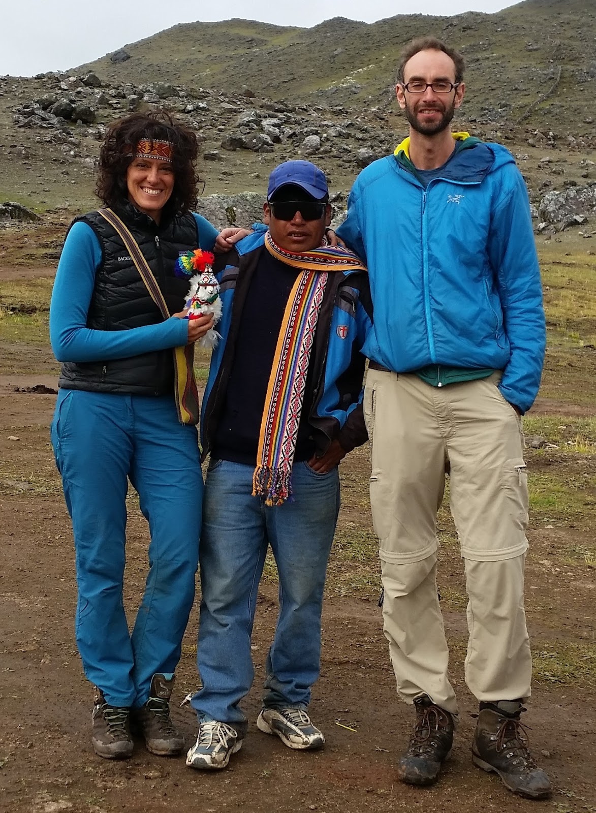
After asking a bit, we meet a guy named Achilles to accompany us. It seems good to us, and we start the route! We will pay him 35 soles per day. We go to Yamana where we find Achilles’ father and the mule that will accompany us throughout the trip.
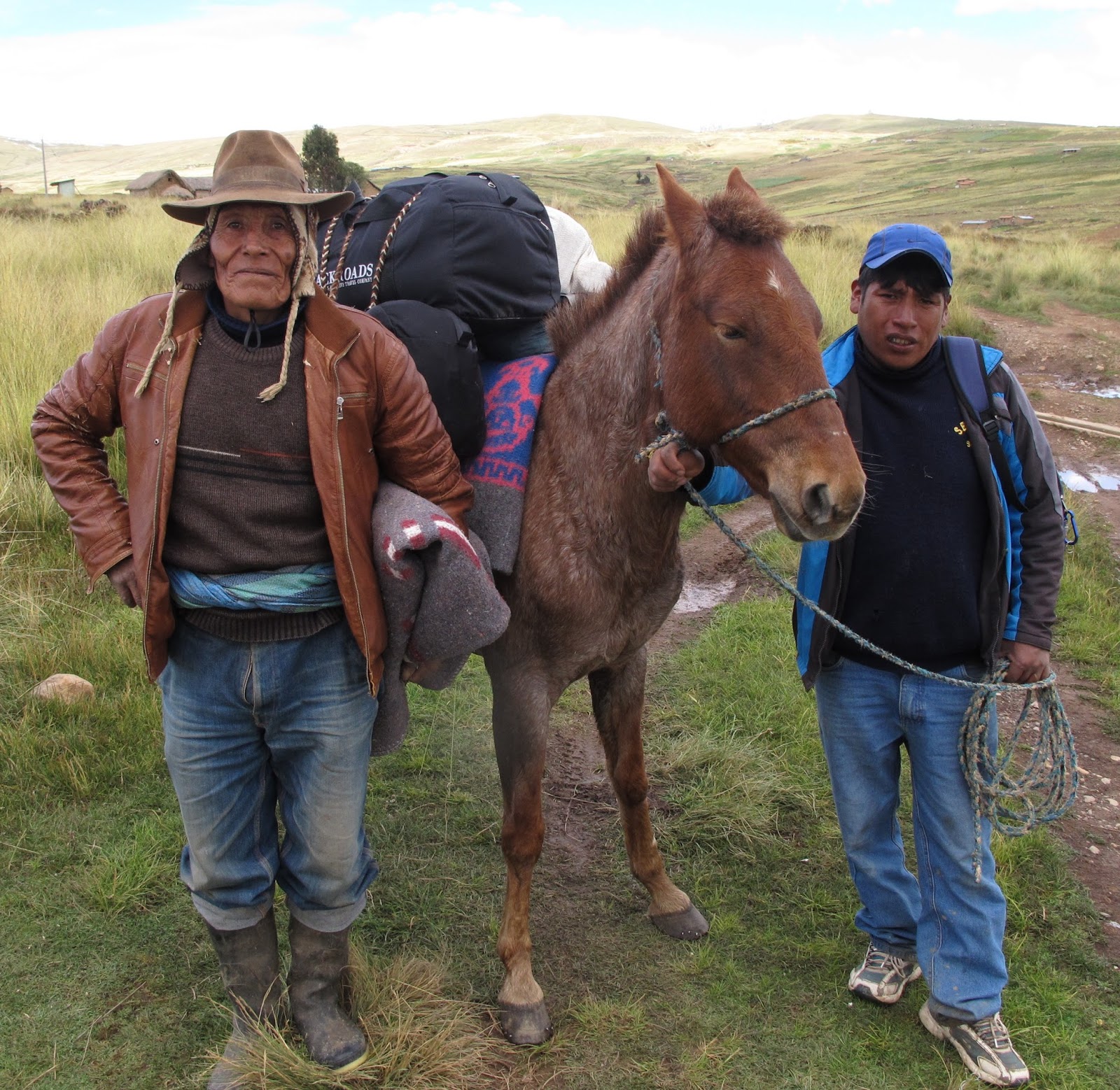
Achilles, with his father and the mule
Lara has brought a toy alpaca which she has named “Monita” and is presenting it to the other alpacas in the valley, who look at her in amazement. The alpacas belong to the camelid family, and are highly valued for their wool and meat. They are a fluffier, smaller version of llamas, like large sheep.
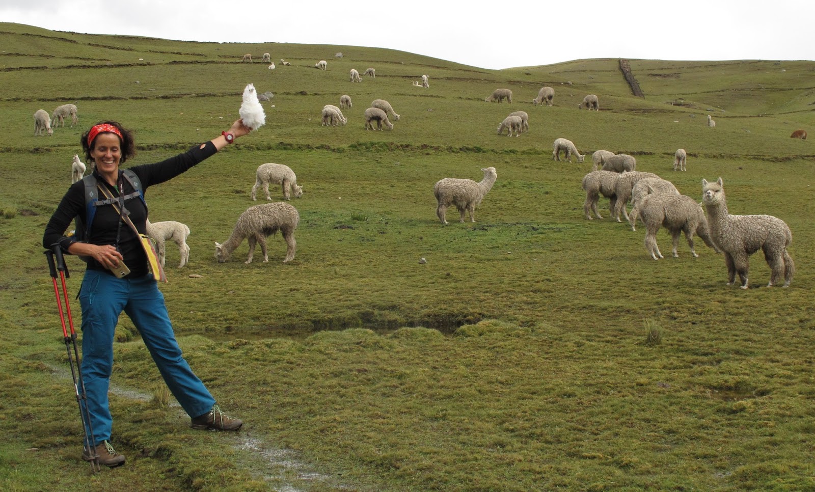
Lara, monita, and a bunch of amazed Alpacas
After a few hours we arrive at Upis at about 4300 meters, where there are hot springs. Although they don’t look very nice, I take a bath, I can’t resist!
Day 2: from Upis to Ausangatecocha (14.3 km, +680m, -470m)
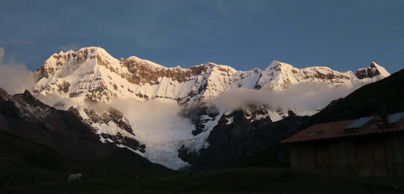
The day begins with a brief moment of clear sky that allows us to admire the north face of the Nevado Ausangate.
 |
|
Fantastic views of Ausangate, photo by Lara Petinal |
Shortly after, it gets cloudy, and we head towards the first pass of the day, the Arapa pass at 4800 meters. Today we are not lucky, and it rains, but the beauty of the hike is such that if the sky is clear, it allows you to see the glacier all the time, and if it is cloudy it allows you to see different colors in the rocks that surround you and herds of alpacas, the basic source of income for local people.
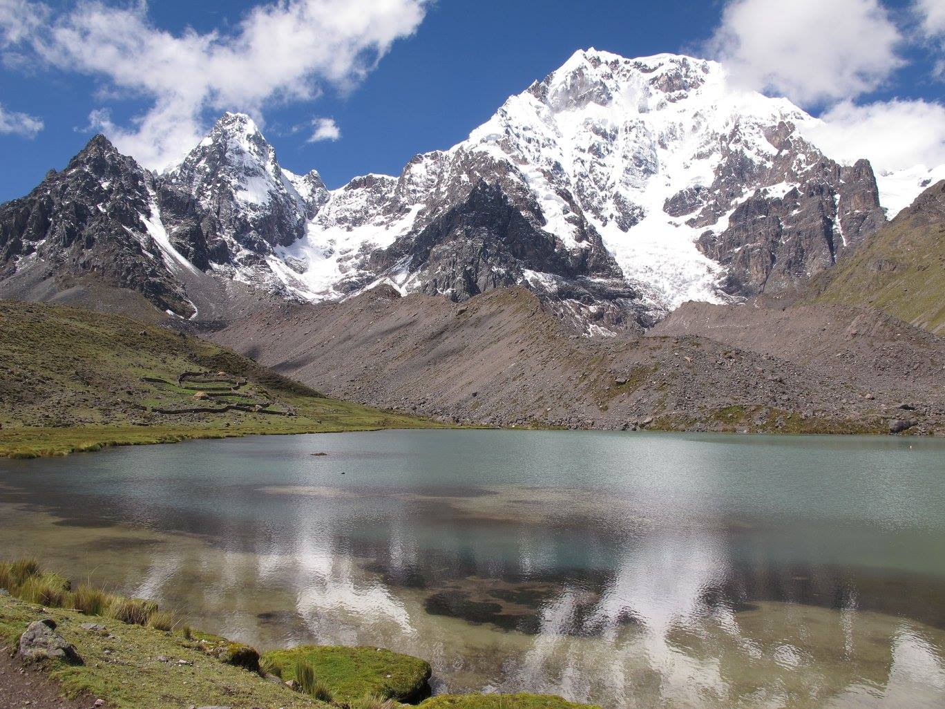
After a few hours, we arrive at Vinococha (it has a reddish color) and Lake Jatun Pucacocha, and although Ausangate is covered by clouds, the glacier, which hangs over the lake is very spectacular.

We are amazed that there are people who live up here, in scattered little houses. They are shepherds and have lived here for generations. If it’s a good day, they can run up to you to sell you some of their handicrafts that help them survive, but today it rains too much and no one comes. We continue walking and pass another pass, the Abra Apacheta at 4900 meters.
We follow the path between herds of llamas with pink laces in their ears and see the camp below us, in the distance. We take advantage of the fact that it is still early and explore some rocks that allow a good view of the glacier: it is very spectacular!
Lara looks like one of those climbers from the old Montblanc photos, and Lake Ausangatecocha stands out at the bottom of the valley between immense walls of red and green colors.
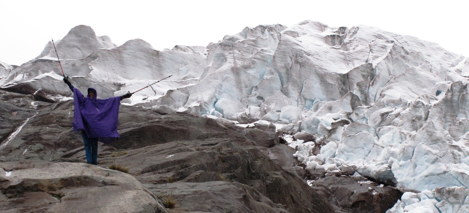
Lara and the Ausangate glacier
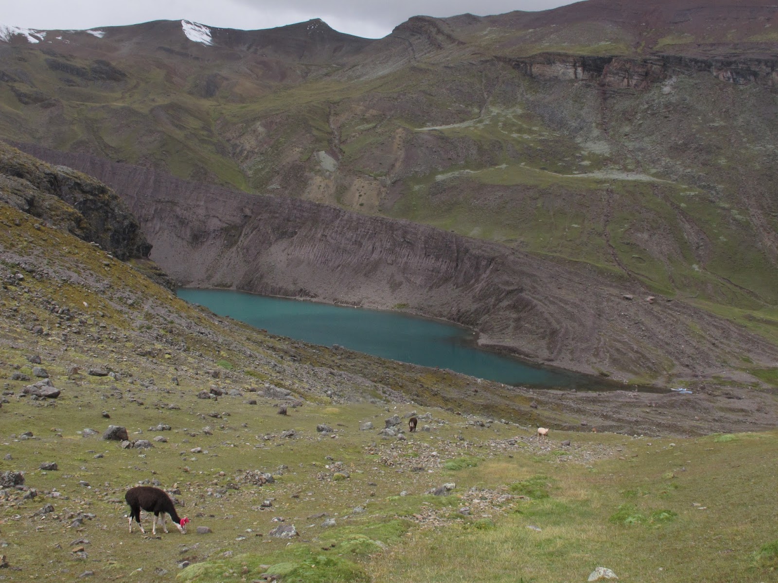
Lama and views of Ausangate cocha
Day 3: from Ausangatecocha to Jampa (11km, +600m, -640m)
During the night I wake up with my eyes wide open and I can’t sleep anymore. In the morning, I feel like I’ve been crushed by a steamroller, with a headache and very bad diarrhea. Obviously, there is no loperamide in the medicine cabinet, I can’t believe it!
Some French people who do the same route and have slept next door give me some. It’s incredible, but it seems that after 6 months in the Andes I’ve got altitude sickness or soroche, as they say in Quechua! It seems that altitude sickness diarrhea doesn’t go away with pills, it’s curious.
Lara is recording videos of Monita greeting the new day, which is spectacular and sunny.
 |
| Camp in Ausangate Cocha, photo by Lara Petinal |
Fortunately, Lara walks with hiking poles and lends me one. Today it’s time to climb the Palomani Pass, at 5200 meters, the highest point of the route. I feel very weak and every 10 steps I stop and rest my head on the pole and I could even fall asleep!
Although I am in a deplorable state, I still want to take some photos. A little snow has fallen in the peaks, and to the south, you can see the colored mountains, which are becoming more and more popular.
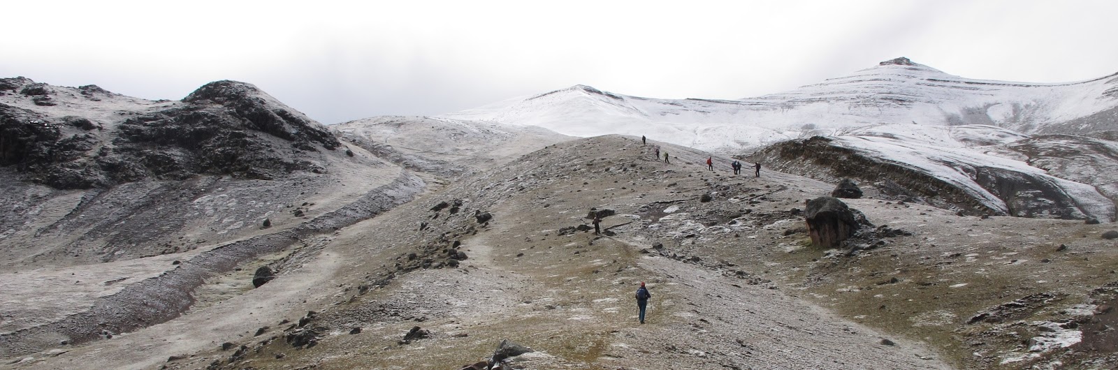
Hike towards Palomani Pass
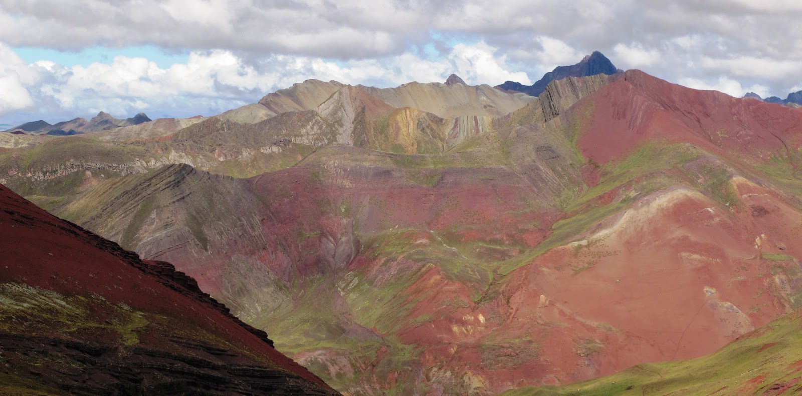
Views towards the popular “Montaña de Siete Colores”
From here to the next camp there is a descent through a huge valley, we cross some wet fields, and then we go up another valley, it seems eternal to me.
It starts to rain, and I do the last minutes on horseback, like a king. I have quite a fever and Lara and Achilles pitch the tent, all I want is to sleep! I hear some strange noises, like a “glug glug glug” by the tent, but I don’t pay much attention and sleep all afternoon.
When I wake up at night, Lara tells me that a young alpaca, a year or two old, has been slaughtered near the tent. Turns out it’s to make a pachamanca for the French the next day. The Pachamanca is an Andean way of cooking in which the food (several types of potatoes, beans, sweet potatoes, meat) is cooked with very hot stones under the ground, it is delicious!
Day 4: from Jampa to Pacchanta (16km, +460m, -753m)
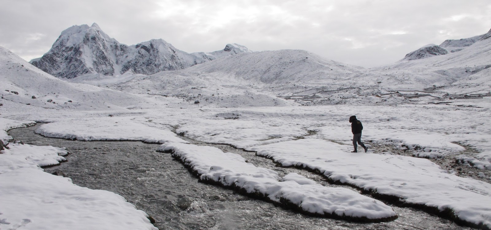
I had a bad night, but today I feel stronger! The landscape is spectacular, with everything covered in snow, and the horses look for some grass under it.
We begin the ascent towards the last pass of the excursion, the Abra Campo at 5076 meters. A shepherd out of nowhere walks in the middle of the valley all covered in snow, a surreal image. And the alpacas continue grazing used to the mountain weather.
Shepherd of llamas on the way to the snowy Abra Campa
Before reaching the pass, we see a few “vicuñas”. The Vicuñas are the smallest camelidae of all, they live freely at 4000 or 5000 meters of altitude and are protected. They have a tuft of very fine wool on their chest, which can cost up to 500 dollars per kilo!
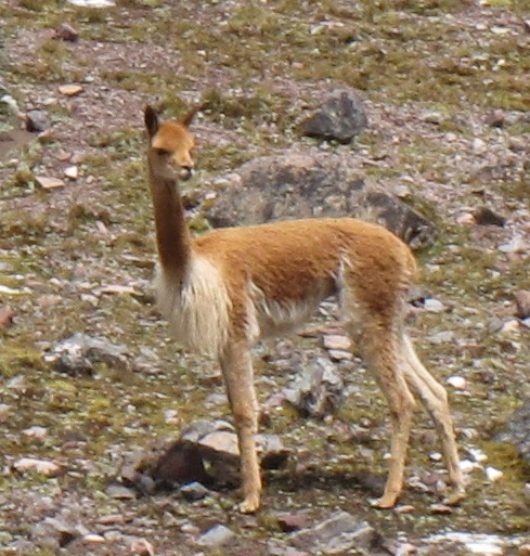
Vicuña
After reaching the Campo pass, getting to the next camp is a breeze. We walk between incredible lakes surrounded by different “snow-capped mountains”. In this area, there are some shelters in case of bad weather.
Fantastic views of the Ausangate lakes
Finally, we arrive at Pacchanta, a small town at 4200 meters with different hostels where you can sleep for 20 soles, a little shop where you can buy something (beer to celebrate the hike, basically) and above all, some fantastic hot springs to bathe while contemplating the Apu Ausangate (they cost 5 soles).
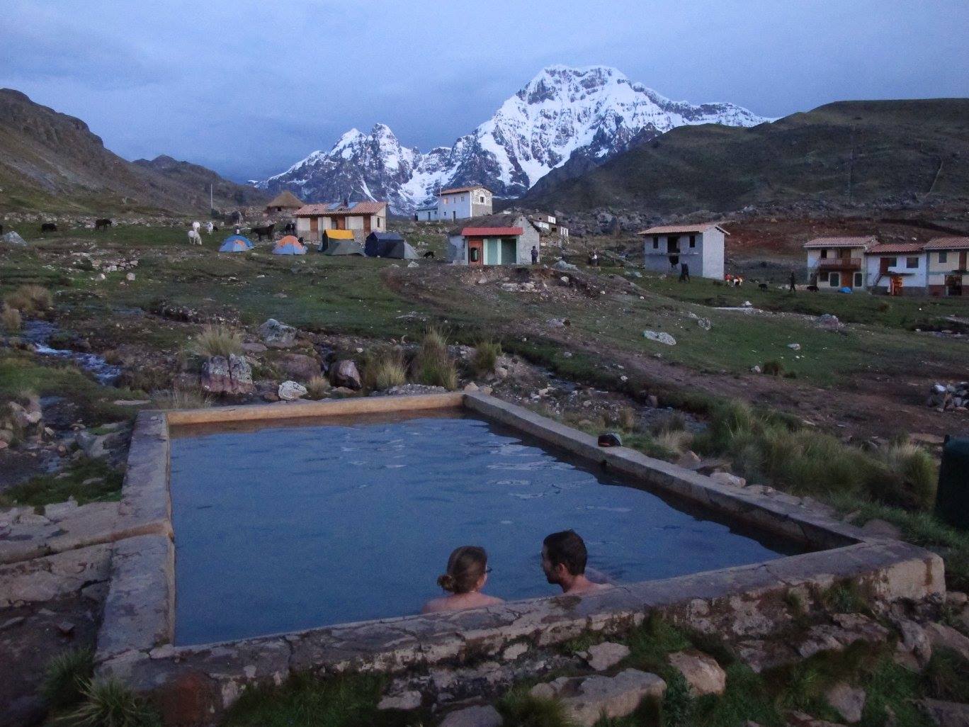
Thermal Baths in Pacchanta
Day 5: from Pacchanta to Tinki and Cusco
Aquiles, Lara, Monita and Yep Yep Yep
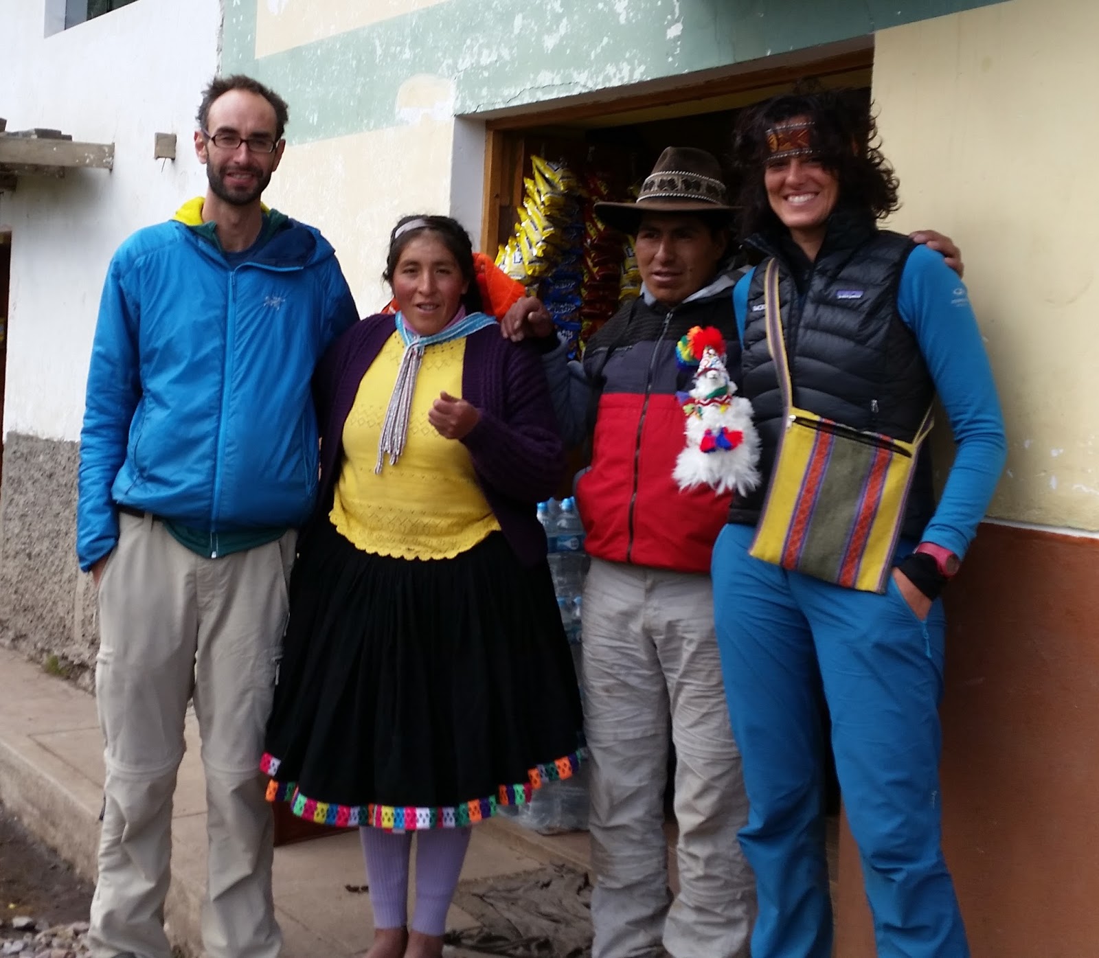
Muy contentos en el hostal de Maria

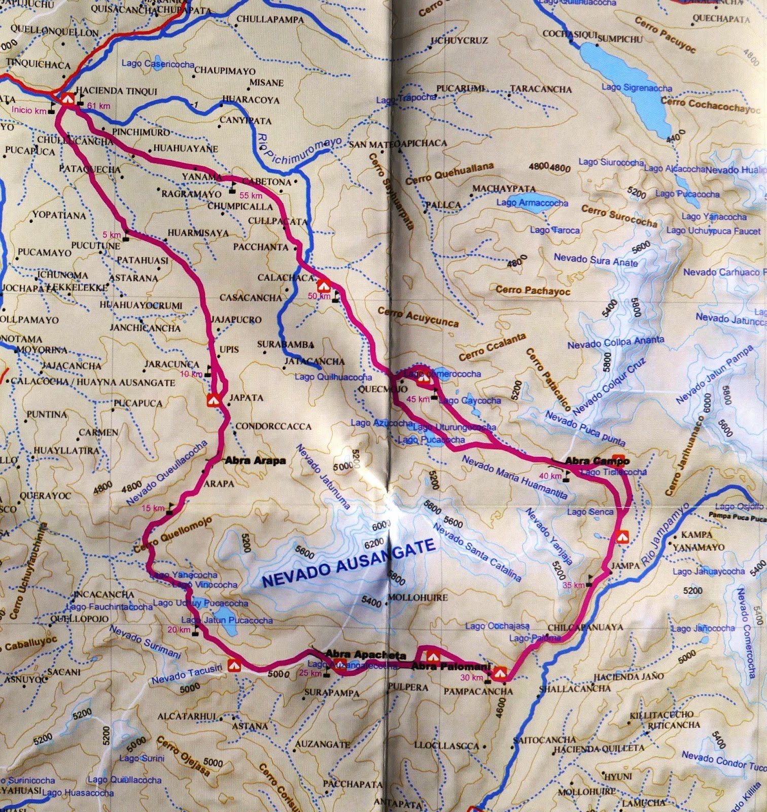
Mapa de la vuelta al Ausangate
Leave a Reply